CEE Associate Professor Dimitrios Zekkos to serve on NASA Disasters Team in new project
Professor Zekkos and the team will advance landslide forecasting using predictive models, satellite data and ground observation.
Professor Zekkos and the team will advance landslide forecasting using predictive models, satellite data and ground observation.
CEE Associate Professor Dimitrios Zekkos serves as Co-PI, along with U-M Professor and Chair of Earth and Environmental Sciences Marin Clark, of a new grant funded by NASA. Led by PI Dr. Dalia Kirschbaum, Research Physical Scientist in the Hydrological Sciences Lab at NASA Goddard Space Flight Center, the project is entitled “Enabling landslide disaster risk reduction and response throughout the disaster life cycle with a multi-scale toolbox.”
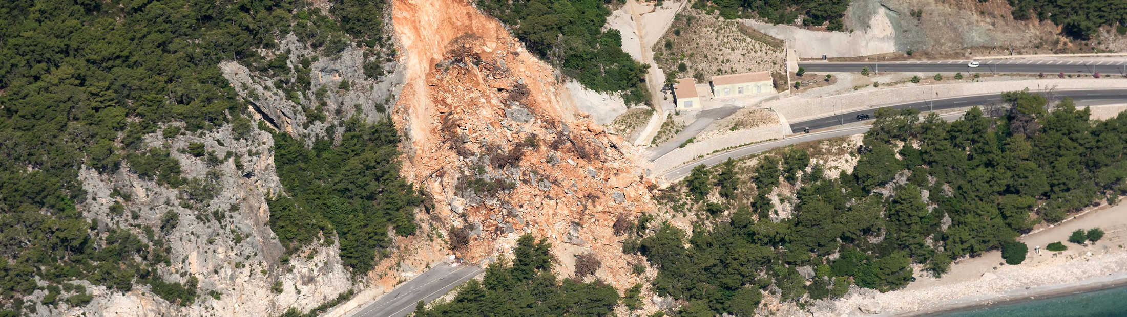
Landslides are a global hazard that causes loss of life and lasting damage to critical infrastructure. A major rainfall or earthquake can cause tens of thousands of landslides which compound losses from damage to transportation networks, inhibit disaster response, and result in cascading effects such as flooding and debris hazards. Despite the ubiquitous nature of landslides, there is little integration of the pervasive impacts throughout the complete landslide disaster life cycle, including preparation, recovery and mitigation.
Zekkos, Kirshbaum and Clark propose to advance landslide forecasting using predictive models, satellite data and ground observation, including evaluation of landslide risk based on the hazard model outputs combined with exposure and vulnerability data. They will address the impact of widespread landsliding triggered by disaster events, including tropical cyclones and earthquakes, where landslides are a significant secondary hazard interrelated with the effects of strong ground shaking and flooding. Given the dynamic nature of the proposed suite of tools, Zekkos, Kirshbaum and Clark anticipate that engagement in Disaster Project Teams will provide new opportunities to integrate their efforts with other teams during natural disaster events that include multiple types of hazards, of which landslides play a pivotal role.
Zekkos, Kirshbaum and Clark rely significantly on NASA data and directly incorporate multiple sensor types, platforms and spatiotemporal scales to model susceptibility, hazard and risk, and also incorporate cascading effects of landslides on other disaster phenomenon. Currently, the Landslide Hazard Assessment for Situational Awareness (LHASA) model represents the only known routinely running global dynamic landslide model that is accessible to the public. The team’s work seeks to advance the current system to incorporate dynamic triggering variables, including forest fires, snowfall and seismicity. Advancement of geomechanical regional models applicable at smaller scales of tens to hundreds of kilometers provide a critical link between ground observations and remote sensing data with satellite-based methods and will be benchmarked using data from several recent past events.
Over the duration of this $695,103 award, Zekkos, Kirshbaum and Clark will contribute forecasts, real-time updates on evolving hazards, and post-event data collection in support of rescue and recovery efforts and longer-term model improvement/validation. The stakeholder partners participating in this effort will directly contribute and co-develop these models, products and tools to ensure seamless transferability and uptake within their decision making systems. These efforts will provide improved situational awareness, disaster risk reduction, response and resilience of landslide hazards relevant to both scientific and stakeholder communities.

Marketing Communications Specialist
Department of Civil and Environmental Engineering
